
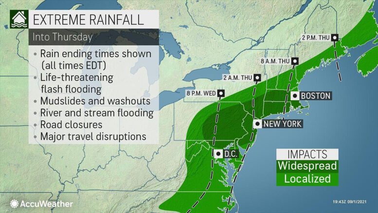
Tropical rainstorm Ida is still a life-threatening storm and is expected to bring additional heavy rainfall and flooding to parts of the Middle Atlantic and Northeast states through early Thursday before lifting away up into Atlantic Canada, according to AccuWeather reports.
The worst of the storm has ended across the western half of Pennsylvania and Maryland.
As of Wednesday afternoon, the center of tropical rainstorm Ida was over central Maryland and tracking toward the northeast direction.
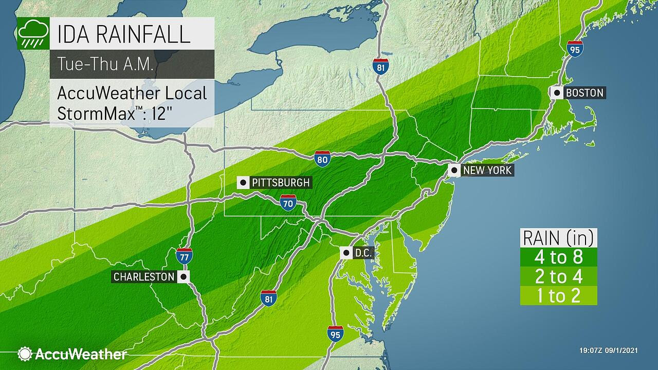
Photo provided by AccuWeather Global Weather Center.
According to an update from AccuWeather Wednesday afternoon, Ida is unleashing very heavy rainfall and significant flooding along and north of its track, while damaging thunderstorms and isolated tornadoes are the primary concern to the south and east of the storm track. Earlier Wednesday there was a tornado that touched down in the Annapolis, Maryland area.
Rainfall rates maybe over an inch per hour at times from eastern Pennsylvania to New England through Wednesday night.
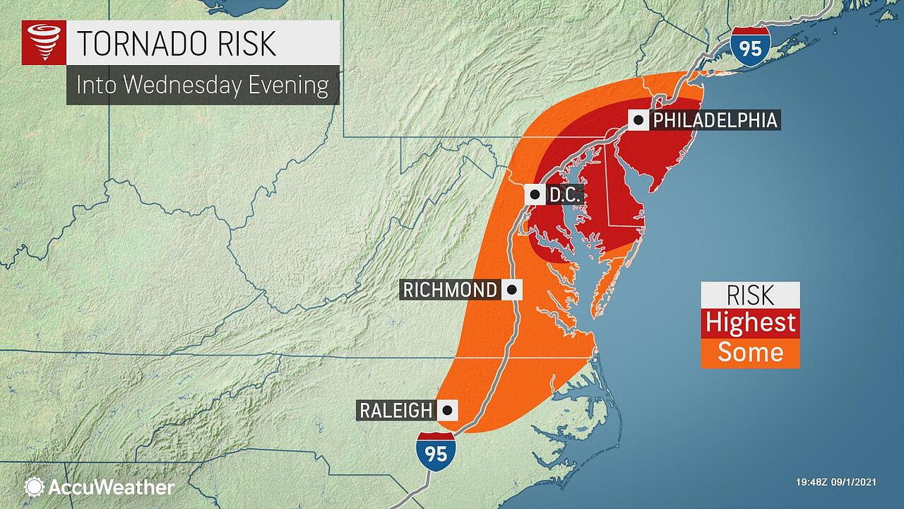
Photo provided by AccuWeather Global Weather Center.
Between 4 and 8 inches of rain may fall on saturated soil, increasing the risk for extreme flooding in low-lying and poor drainage areas along a narrow corridor from Pennsylvania to Massachusetts.
Significant travel disruptions are anticipated as intense rainfall may greatly reduce visibility and cause some low-lying roads to be submerged in water. The Wednesday evening commute along the I-95 corridor may have significant delays, so plan ahead.

Photo provided by AccuWeather Global Weather Center.
Residents in the path of Ida should continue to monitor AccuWeather for additional updates into next week on this extreme weather event.
Farther out in the Atlantic, Tropical Depression Kate is not a threat to land as it will continue on a general northerly track this week.

Photo provided by AccuWeather Global Weather Center.
Farther out in the Atlantic, Tropical Storm Larry has formed and is expected to reach major category 3 strength by late this weekend as it starts to turn more toward the northwest direction. Larry is not expected to be a threat to any land masses through the middle of next week. Beyond that, there is a chance that Larry turns more northward toward Atlantic Canada late next week. Larry may bring increased surf and strong rip currents to the U.S. East Coast sometime next week.
For more information on this weather event, visit https://www.accuweather.

Be the first to comment on "Ida bringing extreme rainfall and flooding to the Northeast"